Essential data for navigation and port operations
GEOGRAPHICAL LOCATION:
The Port of Annaba is located at:
- East Longitude 07° 47’ 03’’
- North Latitude 36° 54’ 11’’
- It is sheltered to the west by the Mount Edough, to the north by Cape de Garde, promontory, and to the south by dunes that extend eastward to Cape Rosa.
ACCESS:
Channels and maritime access routes:
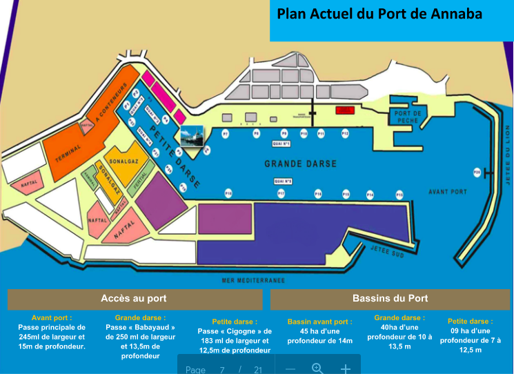
- Outer harbor: via a channel 245 ml width and 15 ml depth.
- Large basin: via the “Babayaud” channel, 250 ml width and 13.5 ml depth.
- Small basin: via the “Cigogne” channel, 183 ml width and 12.5 ml depth.
SHELTERED WATER AREA:
94 ha
- Outer harbor basin: 45 ha, average depth of 14 m.
- Large basin: 40 ha, depth ranging from 10 to 13.5 m.
- Small basin: 9 ha, depth ranging from 7 to 12.5 m.
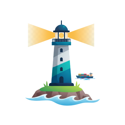

SIGNALIZATION:
Navigational Aids
-
Cape de Garde lighthouse, accompanied by a radiobeacon: 36° 58’ 05’’ North, 07° 47’ 11’’ East.
-
Cape Rosa Lighthouse: 36° 56’ 09’’ North, 08° 14’ 14’’ East.
WIND CONFIGURATION:
Predominantly Northwest and West winds in all seasons.
TIDES AT ANNABA PORT:
SEMI-DIURNAL TIDE:
20 to 40 cm
H.H.W.L.
Highest water level
D.H.W.L.
Exceptional high water level due to the passage of low-pressure systems
H.W.L.
Average value of the high water level
M.W.L.
Average sea surface
A.L.W.L.
Exceptionally low water level due to the development of a high-pressure system
L.L.W.L.
Lowest water level

Ocean Currents
The main ocean currents in the Algerian maritime zone are currents that move eastward. In general, their speed ranges from ¼ to ¾ knots. The speed of the currents in the open sea within the maritime zone of the port of Annaba is between 1 and 2.5 knots, but near the port, weak currents are observed, which are divisions of the offshore currents. From a topographical perspective, the marine currents near the port of Annaba are branches of currents coming from the open sea, and their speed is therefore low. These currents are not strong enough to interfere with ships entering or leaving the port.
Data for information purposes only, not for critical maritime navigation.
Anchorage
- A good holding sand anchorage, sheltered from north and northwest storms, considered one of the safest in North Africa.
- Anchorage is to the east of the south pier in depths of 10 to 12 meters, or in the Genoese Fort bay, about 4 miles from the port, in rocky bottoms ranging from 20 to 30 meters.